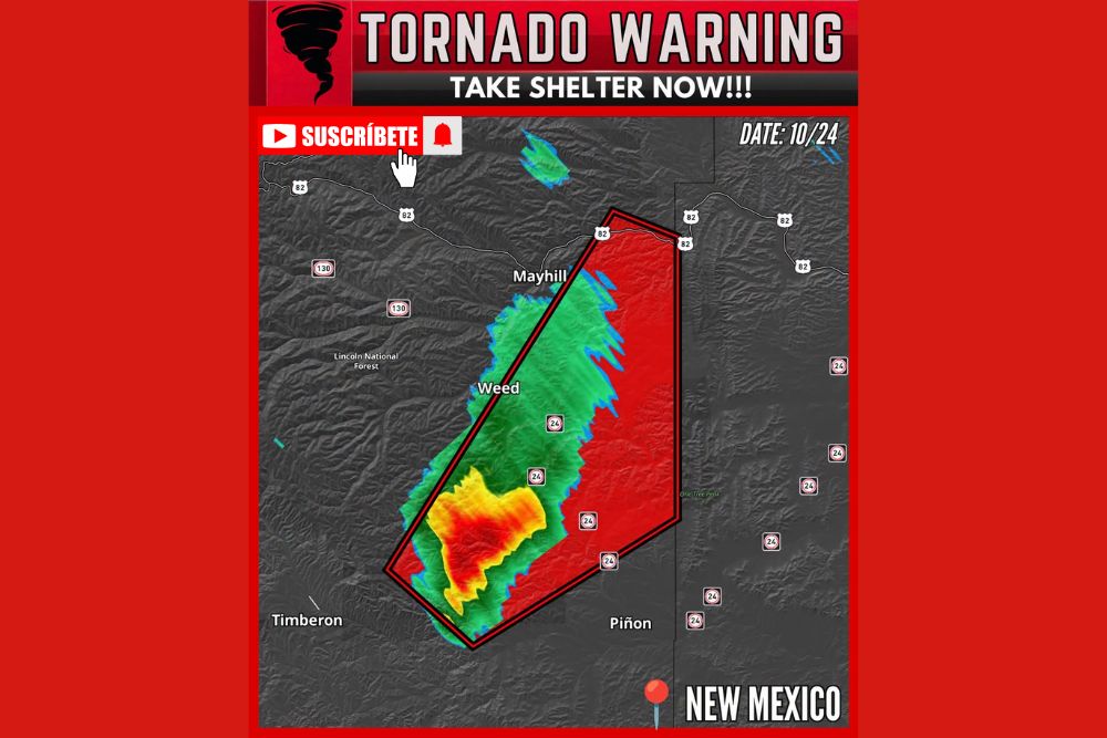
Tornado Warning Issued in Otero County, New Mexico as Severe Storm West of Piñon Moves Northeast at 25 MPH Toward Weed and Mayhill
PIÑON, NM — A tornado warning was issued on Saturday, October 24, for a portion of Otero County in southern New Mexico after a severe thunderstorm capable of producing a tornado was detected 7 miles west of Piñon. The storm was moving northeast at 25 mph, tracking toward the mountain communities of Weed and Mayhill in the Sacramento Mountains. Residents in the warned area were urged to take shelter immediately.
Storm Located West of Piñon
Radar imagery showed the strongest part of the storm southwest of Weed and northwest of Piñon, with an intense core marked by red and orange returns. These colors indicate very heavy rainfall and possibly hail within the storm.
The storm’s position placed it near State Road 24, a key route connecting Piñon, Weed, and surrounding communities through the rugged terrain of the Sacramento Mountains.
Warning Area Stretches Toward U.S. 82
The tornado warning polygon extended northeastward from near Timberon toward Weed, Mayhill, and U.S. Highway 82. The warning covered a long, narrow area along the storm’s expected path, including sections of State Road 24 and rural areas east of the Lincoln National Forest.
Mayhill, located along U.S. 82, sat near the northern end of the warning area, while Piñon was located near its southeastern edge. Residents in nearby areas, including Timberon and Cloudcroft, were advised to stay alert.
Another Rare Tornado Threat for New Mexico
This warning adds to an unusually active stretch of severe weather across New Mexico this week. Tornado warnings have been issued near Deming, Truth or Consequences, and in Grant and Hidalgo counties, where the warning was the first in more than 40 years.
The active pattern has been fueled by deep moisture, instability, and strong wind shear, conditions that are uncommon in the region during late October. Historic rainfall and flooding have also affected northwestern New Mexico and southwestern Colorado.
Mountain Terrain Adds to the Danger
Tornadoes in mountainous terrain can be especially difficult to see, as hills, trees, and heavy rain may block visibility. Residents in the Sacramento Mountains should not wait to see a tornado before taking action.
Heavy rain from the storm may also cause flash flooding in canyons, creeks, and low-water crossings, creating additional hazards for drivers on mountain roads.
Safety Steps During a Tornado Warning
Residents in the warned area should move to an interior room on the lowest floor of a sturdy building, away from windows. Those in mobile homes or vehicles should seek more substantial shelter if time allows.
Drivers should avoid traveling into the storm and never attempt to cross flooded roads.
Damage Reports to Follow
The National Weather Service will review any reports of tornado touchdowns or storm damage in the coming days.
For continuing coverage of severe storms, tornado warnings, and critical weather analysis across the United States, visit Weather Radar.