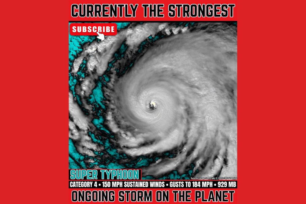
Super Typhoon Champi Packs 150 MPH Winds and 184 MPH Gusts in the Western Pacific as Forecasters Watch for Possible Category 5 Strengthening
WESTERN PACIFIC OCEAN — Super Typhoon Champi remains a powerful and well-organized storm over the western Pacific Ocean, currently ranking as the strongest ongoing storm on the planet. The system is tracking west-northwest with sustained winds of 150 mph, gusts reaching 184 mph, and a minimum central pressure of 929 millibars, placing it at Category 4 strength with signs that further intensification may still be ahead.
A Textbook Super Typhoon on Satellite
Satellite imagery shows Champi with a classic, highly symmetrical structure. A clearly defined eye sits at the center of the storm, surrounded by a thick ring of intense thunderstorms known as the eyewall. Long, curved spiral bands wrap around the system in every direction, a sign of a mature and efficient tropical cyclone.
The storm’s broad circulation spans a vast area of open ocean, with deep cloud tops extending well away from the center. This type of organized appearance typically indicates favorable conditions, including warm sea surface temperatures and low wind shear, both of which support continued strength.
Possible Category 5 Intensity Ahead
Forecasts suggest Champi could strengthen further in the coming days, potentially reaching Category 5 intensity with sustained winds of 165 to 179 mph. A storm reaching that level would rank among the most intense tropical cyclones observed anywhere in the world this year.
The 929 millibar pressure reading already reflects an exceptionally powerful system. Lower pressure generally corresponds with stronger winds, and any further drop would signal additional strengthening.
Weakening Expected Later This Week
While additional intensification remains possible in the short term, forecasters expect Champi to begin weakening later this week. Changes in ocean temperatures, increasing wind shear, or interaction with drier air can gradually disrupt a typhoon’s structure and reduce its strength over time.
Even as it weakens, a storm of this size can maintain dangerous winds and rough seas over a wide area for several days, so forecasters will continue tracking its path closely.
Extreme Seas With Waves up to 55 Feet
One of the most striking impacts of Champi is its effect on the ocean surface. Maximum significant wave heights near the storm are reaching an estimated 55 feet, creating extremely dangerous conditions for ships and maritime operations across the region.
Commercial vessels, fishing fleets, and naval traffic in the western Pacific are expected to steer well clear of the storm’s path. Large swells generated by a typhoon of this strength can also travel hundreds of miles from the center, producing rough surf and hazardous conditions far from the storm itself.
Why Western Pacific Typhoons Matter to the United States
The western Pacific is home to several U.S. territories and military installations, along with major shipping routes connecting Asia and North America. Powerful typhoons in the region can affect air travel, supply chains, and military operations, making them important to monitor even when they remain far from the U.S. mainland.
Officials in the region will issue updated forecasts and advisories as the storm’s track becomes clearer over the coming days.
Ongoing Monitoring Continues
Super Typhoon Champi stands as a reminder of how powerful tropical cyclones can become over warm ocean waters. Forecasters will continue tracking its strength, movement, and potential impacts as it moves west-northwest through the week.
For continuing coverage of tropical storms, typhoon tracking, and critical weather analysis across the United States, visit Weather Radar.