Isolated Severe Storm Risk Develops From Las Vegas to Phoenix as Large Hail, Damaging Winds and a Brief Tornado Threaten Arizona and Nevada
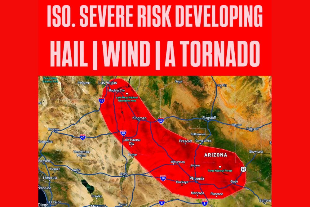
PHOENIX, AZ — An isolated severe weather risk developed across parts of Arizona and southern Nevada on the afternoon of Saturday, October 31, as thunderstorms began forming across the region. The threat is expected to stay isolated, so a severe weather watch is not expected, but the strongest storms could still produce large hail, damaging winds, and possibly a brief tornado. The risk area stretches from near Las Vegas southeast through Kingman and Wickenburg to Phoenix and Globe.
Risk Area Stretches Across the Desert Southwest
The outlined risk zone begins in southern Nevada near Las Vegas, Boulder City, and the Lake Mead National Recreation Area. It extends southeast along U.S. Highway 93 through Kingman and Lake Havasu City, crossing Interstate 40 in western Arizona.
From there, the zone continues through Wickenburg, Prescott, Anthem, and the Phoenix metro area, including Buckeye, Maricopa, and Florence. The eastern edge reaches the Tonto National Forest and Globe along U.S. Highway 60.
Large Hail and Damaging Winds the Main Threats
The strongest storms could produce large hail, which can damage vehicles, roofs, and windows. Damaging wind gusts are also possible, capable of knocking down trees, power lines, and outdoor structures.
In desert areas, strong outflow winds from thunderstorms can also kick up blowing dust, sharply reducing visibility on highways such as Interstate 10, Interstate 17, and Interstate 40.
A Quick Tornado Spin-Up Possible
While the overall threat remains isolated, forecasters noted the possibility of a quick tornado spin-up in one of the stronger storms. Brief tornadoes in Arizona are uncommon but not unheard of, especially during unusually active weather patterns like the one seen this month.
Arizona has already experienced a historic stretch of severe weather in October, including confirmed EF1 tornadoes near Prescott Valley and Fort Valley on October 21.
Halloween Plans Could Be Affected
With storms developing during the afternoon and evening on Halloween, families with trick-or-treating plans across the Phoenix area and western Arizona should keep an eye on the sky. Lightning, heavy rain, and gusty winds could disrupt outdoor activities.
If thunder is heard, residents should move indoors and wait at least 30 minutes after the last thunder before heading back outside.
Flash Flooding Also Possible
Heavy downpours may lead to flash flooding in normally dry washes, low-lying roads, and urban areas with poor drainage. Drivers should never attempt to cross flooded roadways.
Stay Weather Aware
Residents across the risk area should keep weather alerts enabled and monitor updates from the National Weather Service through the evening.
For continuing coverage of Arizona severe storms, Halloween weather, and critical weather analysis across the United States, visit Weather Radar.