Flash Flood Emergency Declared in Pearl River County, Mississippi as 6 to 10 Inches of Rain Near Crossroads Triggers Multiple High-Water Rescues
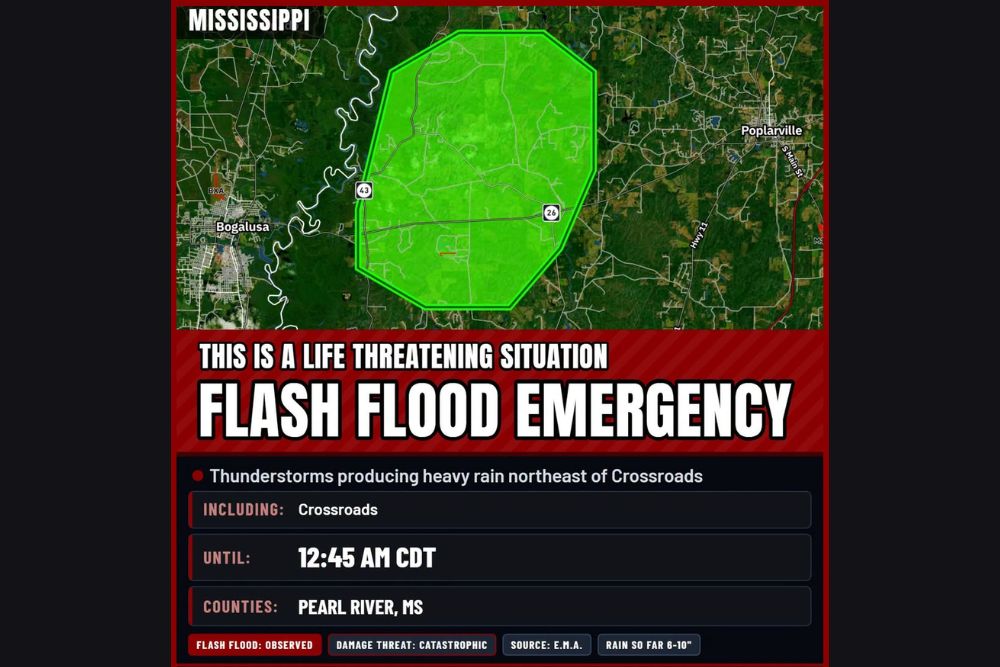
CROSSROADS, MS — A Flash Flood Emergency has been issued for part of Pearl River County in southern Mississippi after thunderstorms dumped 6 to 10 inches of rain northeast of Crossroads. Emergency management officials reported that flash flooding is already occurring, with ongoing high-water rescues and swift-moving water covering multiple roadways. The National Weather Service in New Orleans called it a life-threatening situation, with the emergency in effect until 12:45 AM CDT.
Catastrophic Damage Threat
The warning carries a catastrophic damage threat, the highest level used for flash flooding. A Flash Flood Emergency is issued only in rare situations when severe flooding is happening or about to happen and poses a serious threat to life.
The flooding was observed and confirmed by emergency management, rather than estimated by radar alone. Residents in the affected area are urged to move to higher ground immediately.
Area Covered by the Emergency
The emergency zone covers a large rural area northeast of Crossroads, including stretches of State Highway 43 and State Highway 26. The area sits east of the Pearl River, which forms the border with Louisiana, and between the city of Bogalusa, Louisiana, to the west and Poplarville to the east.
Low-lying roads, creeks, and wooded areas within this zone are most at risk. Water levels can rise very quickly in these areas during intense rainfall.
High-Water Rescues Underway
Emergency crews are carrying out high-water rescues as rising water traps people in homes and vehicles. Swift-moving water across multiple roads has made travel extremely dangerous, and some routes may be impassable.
Residents who are trapped should call 911 and move to the highest floor of their home if they cannot safely evacuate. Officials warn against walking or driving into floodwater.
Why the Rain Was So Extreme
The flooding comes as an El Niño-driven storm pattern pulls deep Gulf of Mexico moisture into the Deep South. Repeated thunderstorms moving over the same area can quickly produce rainfall totals far beyond what drainage systems and creeks can handle.
Rain totals of 6 to 10 inches in a short period are rare even for this part of Mississippi.
Turn Around, Don’t Drown
Drivers should never attempt to cross flooded roads. Just 6 inches of moving water can knock a person down, and 12 inches can carry away a small car. Floodwater may also hide washed-out pavement and debris.
More Rain Possible
Residents across southern Mississippi and southeastern Louisiana should stay alert, as additional storms could worsen flooding overnight.
For continuing coverage of Mississippi flash flooding, Gulf Coast storms, and critical weather analysis across the United States, visit Weather Radar.