Super El Niño Winter Sends a Southern Storm Track Across the Gulf Into Florida, Louisiana and Texas as Heavy Rain Builds in November
TAMPA, FL — A Super El Niño is expected to bring a wet and stormy winter to the Gulf Coast and Florida, with impacts likely beginning in November as the classic El Niño pattern settles in. Forecasters say a southerly storm track will steer systems from Mexico across the Gulf of Mexico and into Florida, bringing more frequent opportunities for heavy rain and severe weather. As the season progresses into December, the same pattern may also open the door to snow chances farther north.
Classic El Niño Pattern Takes Shape
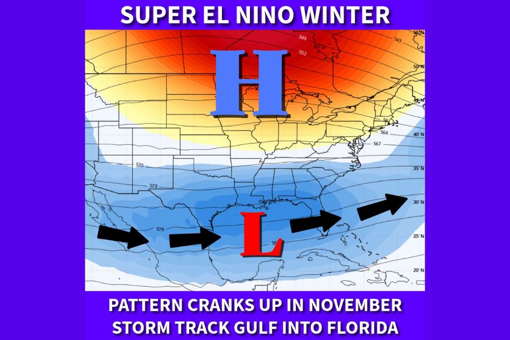
The pattern map shows a broad area of high pressure across Canada and the northern United States, while a low pressure zone sits over the Gulf of Mexico. Arrows indicate a storm track moving from northern Mexico across southern Texas, through the Gulf, and into Florida before heading out over the Atlantic Ocean.
This setup is typical of strong El Niño winters, when the subtropical jet stream strengthens and shifts south, directing a steady stream of storm systems across the southern tier of the country.
Gulf Lows Become More Frequent
As November goes on, forecasters expect developing Gulf lows to form with increasing frequency. These systems can tap into deep moisture from the Gulf and produce widespread heavy rain across Texas, Louisiana, Mississippi, Alabama, Georgia, and Florida.
Florida has already seen its first El Niño-fueled storm during Halloween weekend, with forecasts calling for 2 to 4 inches of rain in parts of Central and South Florida.
Severe Weather Risk Increases
Along with heavy rain, an active southern storm track can increase the risk of severe thunderstorms across the Gulf Coast and Florida. Strong El Niño winters have historically brought more frequent damaging wind events and tornadoes to the region during the cool season.
Residents should keep weather alerts enabled and stay prepared throughout the winter months.
Snow Chances Farther North by December
As colder air builds across the northern United States, the active storm track may begin to interact with that cold air by December. This could create opportunities for snow and ice across parts of the South, Mid-South, and Mid-Atlantic, depending on how storms and cold air line up.
Wetter, Cloudier, and Cooler
Forecasters stress that El Niño will not bring rain every single day. However, the season is expected to be significantly wetter, cloudier, and cooler than normal across Florida and the Gulf Coast.
A Major Shift From Fall
The pattern marks a big change after a dry October that worsened drought conditions across much of the Southeast.
For continuing coverage of El Niño updates, Gulf Coast storms, and critical weather analysis across the United States, visit Weather Radar.