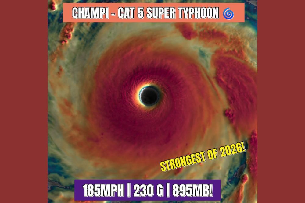
Super Typhoon Champi Explodes Into Category 5 With 185 MPH Winds and 230 MPH Gusts as Strongest Storm of 2026 in Western Pacific
WESTERN PACIFIC OCEAN — Super Typhoon Champi has grown even stronger over the western Pacific Ocean, intensifying into a Category 5 storm with sustained winds of 185 mph, gusts reaching 230 mph, and a minimum central pressure of 895 millibars. The dramatic strengthening places Champi as the strongest storm of 2026 so far, and one of the most intense tropical cyclones observed on the planet in recent years. Fortunately, the storm is tracking westward over open water and is expected to remain away from land.
Rapid Strengthening Since Earlier This Week
Just days ago, Champi was a Category 4 super typhoon with 150 mph winds, 184 mph gusts, and a pressure of 929 millibars. Since then, the storm has undergone significant intensification, with its pressure falling by more than 30 millibars and its sustained winds increasing by 35 mph.
A pressure reading of 895 millibars is exceptionally low and ranks among the most extreme values recorded in tropical cyclones. Lower pressure reflects a more powerful storm, and readings below 900 millibars are reached only by a small number of the most intense typhoons and hurricanes on record.
Stunning Satellite Imagery at Sunrise
Satellite images captured as the sun rose over the storm show a perfectly circular eye surrounded by a thick, symmetrical eyewall. The eye appears clear and well defined, a hallmark of a storm operating near its maximum potential intensity.
The storm’s compact, nearly round structure has drawn comparisons to a truck tire, a nickname often used for intense tropical cyclones with large, symmetrical eyes and very few outer rain bands. These storms tend to hold their strength well because their structure is highly efficient at drawing energy from warm ocean waters.
Tracking West Over Open Water
Champi is currently moving westward across the western Pacific, and current indications suggest it will remain over water. This is welcome news, as a storm of this intensity would cause catastrophic damage if it were to make landfall, with destructive winds, extreme storm surge, and torrential rainfall.
Forecasters will continue tracking the storm’s path closely, as even small shifts in direction could bring changes for islands and shipping routes across the region.
Dangerous Seas Across the Region
Even without a landfall, a Category 5 super typhoon produces enormous waves and extremely rough seas over a large area. Earlier reports showed significant wave heights reaching around 55 feet, and the storm’s strengthening may push seas even higher near the center.
Commercial ships, fishing fleets, and military vessels are expected to avoid the storm’s path. Long-period swells can travel hundreds of miles away from the typhoon, creating hazardous surf conditions far from the center.
Why This Storm Matters
The western Pacific is home to several U.S. territories, military bases, and major shipping lanes linking Asia with North America. Powerful typhoons in the region can disrupt air travel, cargo shipments, and military operations, making them important to monitor closely.
Expected Weakening Ahead
While Champi remains near peak strength, forecasters expect gradual weakening later this week as it encounters less favorable conditions. Until then, it stands as a remarkable example of nature’s power.
For continuing coverage of tropical storms, typhoon tracking, and critical weather analysis across the United States, visit Weather Radar.