Repeated Cold Fronts Keep the Gulf of Mexico Quiet for Texas, Louisiana, Alabama and Florida as Hurricane Season Winds Down Through November
NEW ORLEANS, LA — The Gulf of Mexico is showing no signs of tropical development anytime soon, offering a welcome period of calm for coastal communities from Texas to Florida. A steady parade of cold fronts sweeping through the southern United States continues to disrupt conditions needed for tropical systems to form. While the Atlantic hurricane season officially runs through the end of November, the current pattern suggests the Gulf will remain quiet for the foreseeable future.
Cold Fronts Shut Down Tropical Development
Each passing cold front pushes cooler, drier air across the Gulf Coast and out over the water. This drier air limits the deep moisture that tropical disturbances need to build thunderstorms and organize. Fronts also bring stronger wind shear, which tears apart developing storm systems before they can establish a closed circulation.
Together, these factors create a hostile environment for tropical formation. Even when areas of low pressure try to develop, the combination of dry air and shifting winds makes it extremely difficult for them to strengthen into tropical depressions or storms.
Gulf Waters Remain Warm but Less Supportive
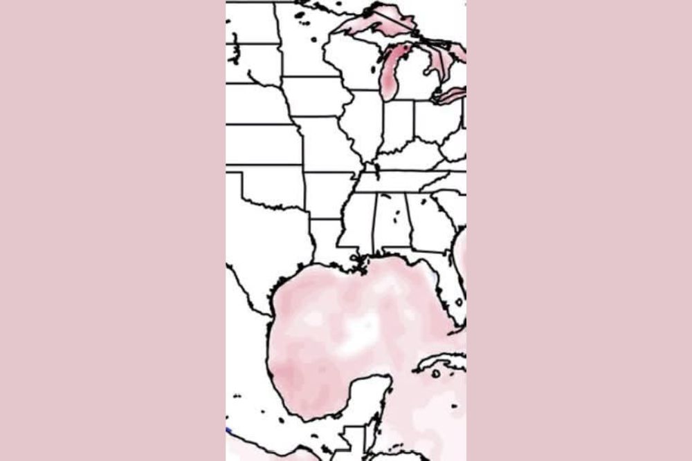
Sea surface temperature analysis shows the Gulf of Mexico still holds a broad area of relatively warm water, particularly across the central and southern Gulf. However, warm water alone is not enough to support tropical development late in the season.
The repeated intrusions of cooler air are gradually reducing the heat available near the surface, especially closer to the northern Gulf Coast. Waters near Louisiana, Mississippi, Alabama, and the Florida Panhandle typically cool more quickly during late October, further lowering the risk of tropical activity close to the U.S. coastline.
Hurricane Season Is Not Over Yet
Despite the quiet conditions, forecasters caution that it is too early to declare the season finished. The Atlantic hurricane season continues through November 30, and late-season storms have formed in past years, sometimes developing quickly in the western Caribbean or southern Gulf when fronts stall and moisture returns.
Residents in hurricane-prone areas are encouraged to keep their emergency supplies in place until the season officially ends. Staying prepared costs little, while a surprise late-season system could catch unprepared communities off guard.
What This Means for Gulf Coast Residents
For now, residents across Texas, Louisiana, Mississippi, Alabama, and Florida can enjoy a period of peace in the tropics. The pattern of frequent fronts is also delivering lower humidity, cooler mornings, and comfortable afternoons across much of the Gulf Coast, a welcome change after a long and hot summer.
Boaters and anglers may notice choppier conditions following each frontal passage, as northerly winds stir up the Gulf. Those planning time on the water should check marine forecasts ahead of outdoor plans.
Watching the Pattern Into November
Forecasters will continue monitoring the tropics as November approaches. Any extended break between cold fronts could allow moisture to return to the Gulf, briefly improving conditions for development. However, current trends favor continued frontal activity, which should keep tropical threats to a minimum along the U.S. Gulf Coast.
A Quiet Stretch Worth Enjoying
The current calm offers a chance for coastal communities to recover and prepare for the cooler months ahead. While vigilance remains important until the season officially closes, the outlook for now favors peaceful skies over the Gulf of Mexico.
For continuing coverage of tropical outlooks, Gulf Coast forecasts, and critical weather analysis across the United States, visit Weather Radar.