Early Season Snow Begins Falling at Mammoth Mountain in California as Sierra Nevada Storm Could Bring up to 10 Inches to the Eastern Sierra
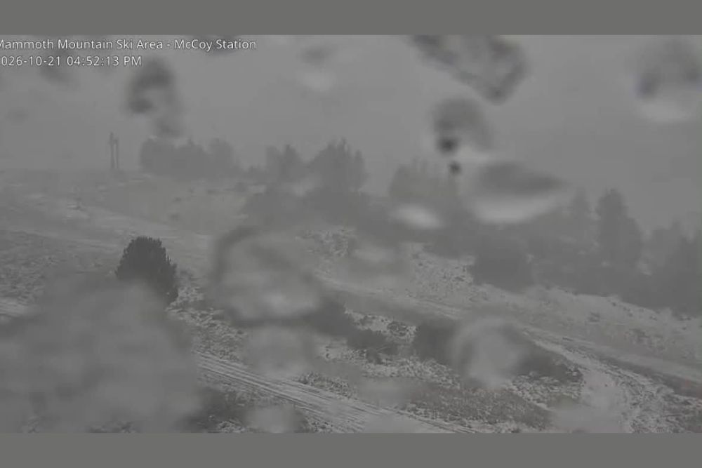
MAMMOTH LAKES, CA — Winter made an early appearance in the Eastern Sierra on Wednesday, October 21, as snow began falling at Mammoth Mountain during the late afternoon. Webcam images captured around 4:52 PM showed snow accumulating on the ground, trees, and ski runs while heavy flakes and low clouds cut visibility across the mountain. Up to 10 inches of snow is expected as the storm continues, marking one of the first notable snowfalls of the season in California’s high country.
Snow Arrives as Webcams Capture Wintry Scene
Live camera views from Mammoth Mountain showed a sudden shift to wintry conditions as the storm moved in. A light coating of fresh snow covered the slopes, with white patches spreading across open terrain and gathering on nearby pine trees. Lift towers and buildings were partially hidden behind thick falling snow and dense fog.
One camera view near the Parallax area showed snow settling on the ground surrounding the structure, while another captured snowflakes collecting on the camera lens itself, a clear sign of the active snowfall underway.
Up to 10 Inches Expected
The developing storm is expected to deliver up to 10 inches of snow at Mammoth, with the heaviest totals likely across the higher elevations of the Sierra Nevada. Snow levels have been forecast to fall to around 7,000 feet in the Sierra as colder air moves in behind the system, allowing snow to accumulate on mountain passes and ski areas.
Snowfall rates may vary through the storm, with periods of heavier snow possible as bands of moisture move across the region. Totals will depend on how long the colder air and moisture overlap over the mountains.
Part of a Larger California Storm System
The snow at Mammoth is part of a broader storm system that has brought rain, thunderstorms, and colder air across much of California this week. While lower elevations have seen showers and storms, the high Sierra is seeing the storm’s colder side, with precipitation falling as snow at higher altitudes.
The arrival of early snow also marks a notable shift after a long and dry stretch for much of the Western United States, offering a first taste of the coming winter season.
Travel Impacts in the Mountains
Travelers heading through the Eastern Sierra should prepare for winter driving conditions. Roads such as U.S. Highway 395 and mountain passes in the Sierra may become slick and snow-covered, with reduced visibility during heavier snowfall. Chain controls may be required on some routes.
Drivers are encouraged to carry chains, warm clothing, water, and emergency supplies, and to check Caltrans road conditions before traveling into the mountains.
Good News for Ski Season Hopes
The early snowfall is welcome news for skiers, snowboarders, and mountain communities eager for the start of the winter season. While one storm alone is not enough to open terrain, early snow can help build a base when combined with cold temperatures and future storms.
What Comes Next
Snow is expected to taper as the storm moves east, with colder temperatures lingering in the higher terrain. Residents and visitors in the Eastern Sierra should continue monitoring forecasts as additional storms may follow later in the season.
For continuing coverage of California snowstorms, mountain travel updates, and critical weather analysis across the United States, visit Weather Radar.