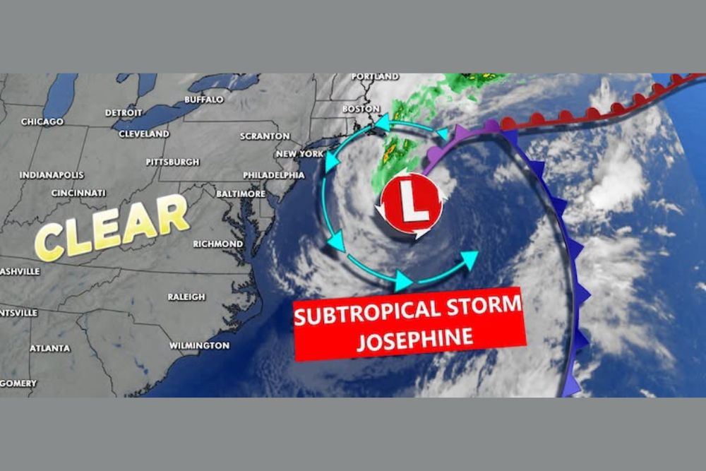
Subtropical Storm Josephine Brings Flood Advisories to Maryland and the Chesapeake Bay as 65 MPH Storm Could Become a Hurricane by Friday
BALTIMORE, MD — Subtropical Storm Josephine is churning off the Northeast coast on Thursday, October 22, and while the storm’s center remains far out over the Atlantic Ocean, its broad circulation is affecting water levels across Maryland, Delaware, and the Chesapeake Bay. Coastal Flood Advisories are now in effect for parts of the region, including areas along the Bay. Josephine is expected to strengthen into a hurricane by Friday as it moves northeast, while inland areas stay sunny and dry.
Josephine’s Latest Position and Strength
As of the 5:00 AM advisory, Subtropical Storm Josephine was located near 38.7 North and 68.3 West, well southeast of New England. The storm carried maximum sustained winds of 65 mph with a minimum central pressure of 988 millibars and was moving northeast at 13 mph.
Satellite imagery shows a large, well-defined circulation with a broad cloud shield wrapping around the center. Its subtropical structure gives Josephine an unusually wide wind field, allowing it to influence weather and water levels far from its core.
Forecast to Become a Hurricane
The forecast track shows Josephine continuing northeast away from the U.S. coastline over the next few days. The storm is projected to strengthen to around 70 mph by Thursday afternoon and reach 80 mph by early Friday, which would make it a Category 1 hurricane.
By Saturday morning, the storm is expected to be well northeast near Atlantic Canada, with winds gradually easing to around 65 mph as it moves over colder waters.
Coastal Flood Advisories Across Maryland and Delaware
Coastal Flood Advisories cover a large portion of the Chesapeake Bay shoreline, including areas near Annapolis, Easton, Cambridge, La Plata, and Lexington Park. Advisories also extend across the Lower Eastern Shore, including Salisbury, Ocean City, and parts of Delaware near Georgetown.
Persistent winds circulating around the storm are pushing water into the Bay and toward the coast, raising tide levels. Minor flooding of low-lying roads, shoreline parking areas, and waterfront properties is possible around high tide.
Gusty Winds Along the Coast
Wind gusts on Thursday morning are strongest near the coastline. Atlantic City is seeing gusts near 31 mph, while Ocean City and La Plata are near 26 mph. Easton reaches around 25 mph, with Philadelphia and Georgetown near 23 to 24 mph. Salisbury and Cambridge sit near 22 to 23 mph, while Baltimore and Annapolis see gusts around 17 to 21 mph.
Inland areas experience much lighter winds, with gusts of only 2 to 13 mph across western Maryland, northern Virginia, and southern Pennsylvania.
Sunny and Dry Inland
Away from the coast, Thursday brings another sunny and dry day across Central Maryland. The lack of rainfall continues to worsen drought conditions, and an updated U.S. Drought Monitor report is set to be released later in the day.
Cooler Air This Weekend
Looking ahead, another push of cool air is expected for the weekend, followed by a warming trend next week. Coastal residents should continue monitoring tide levels until Josephine moves farther away.
For continuing coverage of tropical storms, coastal flood alerts, and critical weather analysis across the United States, visit Weather Radar.